Land surveys have existed for a long time now.
With time, the technology deployed in conducting land surveys and reporting them to its stakeholders has certainly evolved. This has led to more innovative ways of conducting surveys and the need to conduct one for different reasons has changed too.
In the simplest terms, surveying refers to the mapping and measurement of land, sea, and airspace. Surveyors identify the areas, measure them and map them. This provides a detailed description of the boundaries, elevations, and other features of the piece of land.
Land surveyors usually work with sophisticated equipment to make calculations, and produce mapping results. The right technology can help surveyors conduct their job efficiently and in a shorter span of time.
Depending on the requirements, there are different types of land surveying services available. Here are a few of them.
Types of Land Surveying Services
Some of the well-known land surveying services in Calgary, such as Core Geomatics, offer a long list of services for every requirement.
Here are some of the most common land surveying services usually provided by surveying companies in Calgary and other places alike.
1. Boundary Survey: Boundary surveys are utilized to locate the boundary lines and perimeters of a property. This involves research on the field as well as on record, including any computations, and measurements, which are required to set the boundary, applicable to the laws of Calgary.
2. Construction Surveys: Construction surveys are another type of land surveying service that works by staking out structures located on the property, including walls, boundaries, buildings, and roads. A construction survey involves the land surveying team working closely with the construction team.
The results of the survey conducted can help assist the development team or maybe help them tweak their existing plans.
3. Location Survey: This is somewhat similar to a boundary survey. A location survey works by providing additional information on the location of internal improvements. This survey is used to fulfill the requirements of a zoning permit or a loan application too.
4. Topographic Survey: The purpose of a topographic survey is to locate natural and man-made structures and features on the piece of land. These features include fences, utilities, buildings, elevations, streams, trees, improvements, and contours.
Topographic surveys are essentially used by a state or local government for planning and site improvements and developments. Moreover, engineers and architects can use these for planning site improvements and development.
These surveys are implemented through a combination of aerial photography and fieldwork.
5. Site Planning Survey: A site planning survey can say to be the combination of a boundary and a topographic survey. It’s used to plan design improvements and developments before the actual construction begins on the site.
These surveys are often used for designing house lots, subdivisions, stores, playgrounds, and streets and highways.
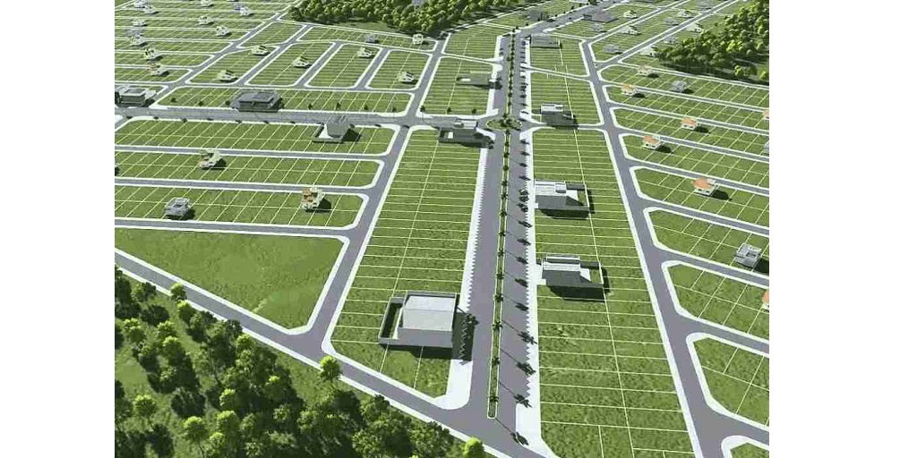
6. Subdivision Survey: A subdivision survey or partition survey is used to divide parcels of land into smaller lots, or estates. They are then supposed to be approved by the local or state government. The subdivision’s approval has to be taken before the construction begins on the lot.
Which Land Surveying Service You Might Need?
There’s a long list of land surveying services available in Calgary.
However, when it comes to determining the one that might be required, a land surveying specialist can be consulted. With the help of an expert onboard, it becomes easier for landowners to identify what’s right for them.
Getting a renowned land surveying specialist such as Core Geomatics onboard can be a practical idea. Their long list of services starts with a planning and consultation session and ensures that the final project is considered complete after all the regulations are met.
Since 2009, the team at Core has been using the best technology which enhances the efforts made by the experienced set of surveyors onboard. While they deliver the best results, the priority for them at each stage is to ensure the safety of all their employees working on the job.
Check out Core Geomatics and its set of services today.